Camp Wihakowi Dam Removal
Check our Flickr gallery for photos and videos of the active removal!
Here is a Story Map by Dana Allen, FluidState Consulting, that shows changes in the site throughout the project.
Friends of the Winooski River managed the project of removal of the Camp Wihakowi Dam from Bull Run in Northfield, Vermont. Engineering oversight on the project was provided by SLR, with Jessica Louisos serving as project lead engineer. Excavation services were provided by Hilltop Construction, Inc, Kolbey Haupt, principal.
The Camp Wihakowi Dam (ID# 143.08) was a barrier to aquatic organism passage on Bull Run in Northfield. The dam was built circa 1920 to create a large pond for a youth summer camp. A small portion of the dam was breached in the late 20th century, but the dam continued to hold nearly 100 years’ worth of accumulated sediment behind it.
Failure of the dam was inevitable, as the owners, Lisa and Jonathan Burr, did not intend to rebuild it. They operate a lodging and dining business on the property, and maintain a public hiking trail to the cascades. The dam failure could have been a gradual process, or a sudden failure could have occurred during a high-flow event. In either case, the impounded sediment would have been released downstream and made its way to Lake Champlain. A sudden release would destabilize downstream reaches, and have a significant negative impact on habitat and biota.
Bull Run rises in Roxbury and flows north into the Dog River in Northfield. The total watershed area of Bull Run is approximately 9.3 square miles, with 8.6 square miles above the Camp Wihakowi Dam. Bull Run contains abundant brook trout upstream and downstream of the Camp Wihakowi Dam, and it is a B1 water for fishing. Removing the Camp Wihakowi Dam restored fish passage to at least 6.3 miles of main stem river (third order or larger), as well as many more miles in smaller tributaries. Wild trout can now access more than 20 miles of upstream habitat that will be critical for providing cold water refuge as our average summer temperatures continue to rise.
The partial breach of the dam notwithstanding, the dam disrupted downstream sediment transport, resulting in upstream sediment accumulation and downstream scour. During Tropical Storm Irene, and other recent large storms, the dam is reported to have exacerbated upstream flooding, which caused severe erosional damage to land and infrastructure. Removal of the dam, which is located at the head of a bedrock reach, restored stream equilibrium and reduced downstream erosion.
Funding was provided by The Nature Conservancy, Vermont Natural Resources Council, LCBP, Vermont DEC, US Fish & Wildlife Service, and the Eastern Brook Trout Joint Venture.
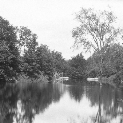
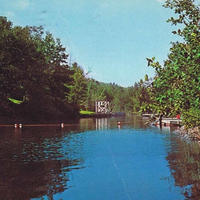
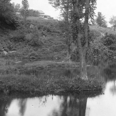
Northfield Historical Society has shared a few photos of the original reservoir: